Garmin Connect may draw map for your route. This tracks may be available for other people. But your device must have GPS.
I don't want use GPS, but I like to share my tracks. I wrote programm for that. It adds GPS data of path, that I draw on map, to TCX-file. Then it is possible to upload this file to Garmin Connect.
Programm URL - https://qwertovsky.com/gps4tcx/
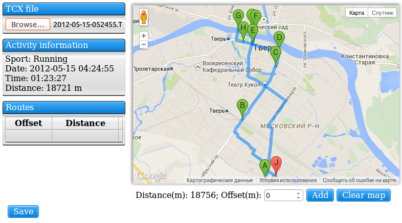
At first, upload your tcx-file. You see a information about this training. Pay attention to the distance.
Then you must draw route that roughly corresponds distance of your training. Route should be longer than training. There is length of route under map.
Two map services are available now: Google and Yandex.
On Google maps you can choose starting point and
direction. Two points are enough to draw shortest path.
Google maps draw a road direction. So Google service is
suitable for road bike trainings.
On Yandex maps you can draw polyline. It is suitable for
off-road trainings.
Press "Add" to add route to training. It is possible to
add more than one route.
Press "Save" to save tcx-file with GPS data on disk.
JavaScript does all work in your browser without request to my server. So page may hang on save for 5 second or so.